Blog Header

Blog Header

Saturday, 3 February 2024

Provence Trip June/July 2023 - Part 4 La Col de la Bonette (Scenery)

The Col de la Bonette is on the stretch of D64 that links Jausiers, near Barcelonnette to the village of St Etienne de Tinée in the Alpes-Maritime dept, which eventually links Nice to Barcelonnette and beyond in the summer months when the col is open. Most of the road lies within the Mercantour National Park. Originally a mule track, transformed into a road in 1832, then classified imperial in 1860 by Emperor Napoleon III, the road as we know it was completed in 1964 but it took another ten years for the loop road around the Cime to be completed.

At 2,715 m the Col de la Bonette is one of the highest paved road passes in Europe; apparently if you allow for the extra loop road around the Cime de la Bonette, which reaches 2,802m, it is the highest paved through road. The loop road is, however, not a col (pass)! There are higher non through roads, there are higher passes and there are higher unpaved roads but there is one thing which is not disputable, and that is that it is a very high route indeed!

There are a number of abandoned military forts and bases up in the mountains as we are very close to the Italian border here and they stem from the days when France was protecting its Alpine borders from the Italians. You can see a fort in the following photo on the right - click to view larger.
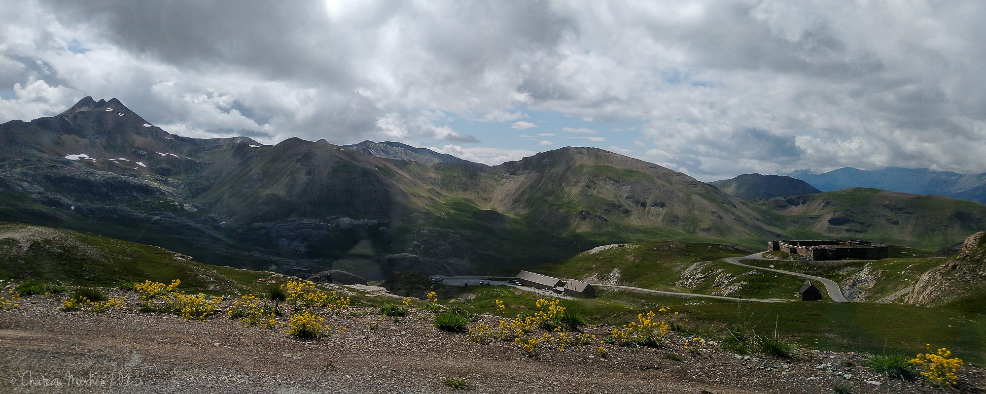

You can see the loop road in the following two photos - not the obvious road below but up in the grey rocky area - and the Cime (which means peak) is at 2,860m. The Tour de France has included this pass a number of times in the past and will again this year.


We didn't actually do this loop - you don't have to as you can just ignore that extra section and start going downwards after the actual pass. I would have loved to have stopped there and climbed up to the top of the Cime, where there is an orientation table. Looking ahead though, we could see those snow drifts and were a bit unsure. It's not like we could have turned around on the road to come back and reversing a motorhome wasn't going to be great deal of fun! So we did the boring but sensible thing.

There wasn't much traffic and the road was well looked after and definitely ok to do in a 7m motorhome at the beginning of July. I'm not sure about travelling it during the school summer holidays though.


I'm pretty sure this drift was actually just before we came to the col, further reinforcing our decision to miss the loop!


And down the other side.


Fourches Camp, another abandoned military site.


I didn't take so many photos coming down as going up. At this last place where we were able to stop the whole hillside was covered in Yellow Rattle (Rhinanthus minor).


Yellow Rattle.


I've never seen a Foxglove like this before - Large Yellow Foxglove (Digitalis grandiflora), native to southern Europe and Asia.


This day was, for me, the highlight of our two week trip - between the scenery and the alpine wildflowers it was absolutely outstanding. There were even butterflies at the beginning of the day, some of which I have shown on my Butterflies in Provence post. I can't wait to revisit the col, though on a warmer day might be nice!

We spent the night at Isola in the Tinée valley before continuing on our journey.

Wednesday, 31 January 2024

Provence Trip June/July 2023 - Part 3 La Col de la Bonette (Wildflowers)

This day dawned lovely and sunny and we went for a wander around Barcelonnette, which is quite a pretty place. We were lucky to find it was market day, so my brother and I who were after honey, had a good mooch around and a honey taste here and there. (I found later in the year that the local honey producers selling at a fete in my village were a lot cheaper - Provence markets are aiming at tourists, after all! I'll know better in the future).


And off we set - up to the highest paved road in Europe, supposedly! at 2,715m altitude. I had researched this road on the internet as I wanted to know if it was doable in a 7m motorhome. The answer was yes, but not if you suffer from vertigo. That was no longer going to stop me!


In the first place that we stopped where I came across butterflies puddling, I also had a good look around the wildflowers. This was at about 2,000m altitude.

Most of the IDing has been done with PlantNet so I will blame them if my IDs are incorrect!

Burnet Rose (Rosa spinosissima).


Further along and higher still, we stopped beside a lake and a valley with a little stream running through. Wildflowers abounded and it was fabulous! It was quite a lot cooler by now though.

In the following photo there is Alchemilla mollis and Thyme plus various other little flowers.


Alpine Birds-foot Trefoil (Lotus alpinus) and Alpine Chickweed or Mouse-ear (Cerastium alpinum).


Clockwise from left: Betony-leaved rampion (Phyteuma betonicifolium), Alpine Clover (Trifolium alpinum), Alpine Avens (Geum montanum) and Peacock-eye Pink (Dianthus pavonius).


Alpine Thrift (Armeria alpina).


There was a high mountain lake, with a few people fishing in it. There didn't look like any life in it, but I guess there was some kind of mountain fish or they wouldn't be fishing!


A Gentian (Gentiana utriculosa) on the left, Alpine Bellflower (Campanula alpestris) and me with camera in hand.


In the boggy patch beside the stream I came across two different orchids, on the left a Marsh Fragrant Orchid (Gymnadenia densiflora) and a Dactylorhiza, though I can't be sure which one it is. PlantNet has given me Dactylorhiza majalis subsp. alpestris or Broad-leaf Marsh Orchid (Dactylorhiza majalis). It has quite wide spotty leaves so I think it is the Alpine Dactylorhiza.


A little bit further up the road we spotted a Marmot; this was my brother's first sighting of one so I was really pleased about that! It was closer than the ones we had seen in the Pyrenees, but it didn't hang around for long.


A little pond and views of the treeless ridges as we travelled higher.


And so we continued, higher and higher ..... to be continued in Part 4!


Friday, 26 January 2024

Provence Trip June/July 2023 - Part 2 Lavender Fields, Verdon Gorge and Col d'Allos

The next morning with new tyres fitted we finally made it to the Valensole plateau, and boy was there lavender! Miles and miles of it in places. I was in my element. 😀


At the next stop (next three photos) the different lavender varieties were labelled, which I found very useful. We had learned about the three different kinds of lavender used in perfume and cosmetic production - True (Lavandula angustifolia), Aspic (L. latifolia) and Lavandin (L. x intermedia), which is a hybrid of the two, at the lavender farm we visited the previous summer. Within each of these three there are different cultivars though, just to confuse us all. 😁  


The smaller lavender is usually the true lavender, L. angustifolia, like the following photo.


No butterflies in sight though, which was really disappointing. There had been dozens at the lavender farm the previous year in the Ardeche.


Yet another lavender farm - some had shops selling their own products. In a number of fields were women dressed up in pretty white summer dresses doing their best Instagram posing!


On this plateau there were two other plants which I assume are also used for the perfume or cosmetic trade, but I don't know what they are. I could only take photos as we were driving past.


This looks like it might be Curry Plant (Helichrysum italicum), though that doesn't exactly smell nice, or perhaps Cotton Lavender (Santolina) which doesn't smell I don't think. Note the white dress!


After the plateau we passed Lac St Croix and headed down the Verdon gorge.


We didn't see the best bits of the gorge as due to time constraints we took the shorter route and K and I had already done the longer one in October 2017 when the leaves were turning a lovely colour. Still, what we could see was quite stunning, though on this particular road there were fewer places to stop to take photos.


We stopped for the night at Castellane, beyond the gorge but still on the river Verdon. We were to follow this river to near its source higher in the mountains.

Castellane was a small town with an interesting rock towering over it, with a cross built right on the top. We had a walk around the town the next morning, but none of us fancied hiking up there!


From here we headed north up the upper Verdon river valley through St Andre les Alpes, Colmars and Allos to Barcelonnette, via the Col d'Allos. The higher we went, the colder and cloudier it got, until we were up in the drizzle!


This road wasn't ideal in a motorhome, but we managed fine. I'm just glad we weren't coming down as it was rather narrow in places and might have set off my vertigo, which I have managed to quell quite well in recent years. When we reached the summit at 2,250m altitude it was really chilly with nothing to see as we were up in the clouds. So we headed on down to our campsite in Barcelonnette and hoped for fine weather for the next day, our really high altitude day!


Part 3 and the famed Col de la Bonette to come!