
At 2,715 m the Col de la Bonette is one of the highest paved road passes in Europe; apparently if you allow for the extra loop road around the Cime de la Bonette, which reaches 2,802m, it is the highest paved through road. The loop road is, however, not a col (pass)! There are higher non through roads, there are higher passes and there are higher unpaved roads but there is one thing which is not disputable, and that is that it is a very high route indeed!
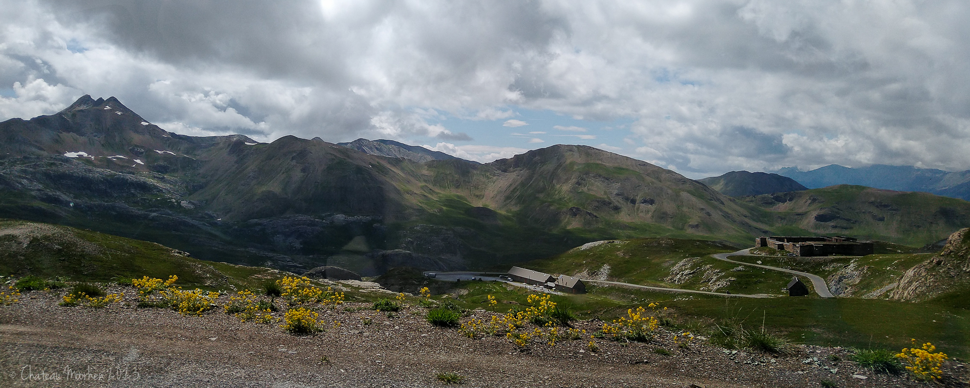
There are a number of abandoned military forts and bases up in the mountains as we are very close to the Italian border here and they stem from the days when France was protecting its Alpine borders from the Italians. You can see a fort in the following photo on the right - click to view larger.
You can see the loop road in the following two photos - not the obvious road below but up in the grey rocky area - and the Cime (which means peak) is at 2,860m. The Tour de France has included this pass a number of times in the past and will again this year.

We didn't actually do this loop - you don't have to as you can just ignore that extra section and start going downwards after the actual pass. I would have loved to have stopped there and climbed up to the top of the Cime, where there is an orientation table. Looking ahead though, we could see those snow drifts and were a bit unsure. It's not like we could have turned around on the road to come back and reversing a motorhome wasn't going to be great deal of fun! So we did the boring but sensible thing.
There wasn't much traffic and the road was well looked after and definitely ok to do in a 7m motorhome at the beginning of July. I'm not sure about travelling it during the school summer holidays though.


I'm pretty sure this drift was actually just before we came to the col, further reinforcing our decision to miss the loop!

And down the other side.


Fourches Camp, another abandoned military site.


I didn't take so many photos coming down as going up. At this last place where we were able to stop the whole hillside was covered in Yellow Rattle (Rhinanthus minor).

Yellow Rattle.

I've never seen a Foxglove like this before - Large Yellow Foxglove (Digitalis grandiflora), native to southern Europe and Asia.

This day was, for me, the highlight of our two week trip - between the scenery and the alpine wildflowers it was absolutely outstanding. There were even butterflies at the beginning of the day, some of which I have shown on my Butterflies in Provence post. I can't wait to revisit the col, though on a warmer day might be nice!
We spent the night at Isola in the Tinée valley before continuing on our journey.
The route does look very high but such stunning scenery and the photos are wonderful. The Yellow Foxglove is unusual and interesting it is native - over here you only see yellow ones in gardens. I am not surprised you want to revisit and hope you can but as you say in warmer weather!!
ReplyDeleteThanks very much Caroline. Sorry for inundating with my posts - it’s not like me posting twice a week, is it? I’ve been enjoying going through my holiday photos and it’s so nice to have it all like a journal for later years. I only managed to do one other complete holiday on my blog. The other trips I peter out before the end! 😁
DeleteFirst time I’ve ever seen a yellow foxglove, not even in gardens! Also that day was due to be 6C on the Col, yet a few days later the forecast was 19C. If it had been warmer, there might have been some interesting high altitude butterflies at the place with the lake and stream. One day! 😄
Oh heck, now I’m Anon. It’s Mandy in France. 😁
DeleteWow.... what an adventure! I would have been so excited to see the Foxglove :-)
ReplyDeletePS.. comment from Marianne in AZ
DeleteThanks so much Marianne! I could see those foxgloves as we were driving along, unable to get a photo, but luckily we found a place to stop where there were a few. They are so different from the ones I’m used to - pink, or sometimes white.
Deleteit’s Mandy!
DeleteI have to now get my map out Mandy and see where you've been as some places ring a bell, I'm getting old and can't remember them all 😂😂😂. Stunning scenery in your write ups 👍 . Trev
ReplyDeleteThanks so much Trev. You have definitely been to Barcelonette, as I remember seeing your photos when you were up in the mountains here. You will have to look back at your photos! xx
DeleteThose views! I love abandoned things so would love those forts and military bases.
ReplyDeleteThanks Mandy! Easy enough to stop if you are in a car, so I am sure you will come across plenty when you do your Alps road trip!
Delete